The three-day Blue Ridge Parkway itineraries sitting at the top of Google right now will drive you straight into a road closure. Most of them send you north out of Asheville to Crabtree Falls at milepost 339.5, then on to Linville Falls at milepost 316. In October 2026 Crabtree Falls is unreachable, sealed inside a closed stretch of road, and Linville Falls is reachable but stripped: the spur road has reopened, everything built around it has not.
Hurricane Helene hit the Parkway in September 2024 and the Park Service has counted 58 catastrophic landslides, with the worst of the roadway damage concentrated between Linville Falls near milepost 317 and Mount Mitchell near milepost 355. Repairs are moving, but the big central gap is not due to reopen until “late 2026,” which does you no good if you’re booking a trip for peak color.
Here’s the good news the doom-posting misses: the two stretches that are open are the two best fall drives on the whole Parkway, and they both start within 20 minutes of downtown Asheville. Base yourself there for three nights and you get a better trip than the point-to-point drive most people attempt.
What’s actually closed this fall
Mileposts on the Parkway count up from north to south, starting at zero near Waynesboro, Virginia. The Park Service refreshed its official status map at 8 a.m. on August 20, 2026, and it keeps changing that map during the day, including short notice closures for tree removal. As it stood that morning, these are the gaps that matter in North Carolina:
- Milepost 333.9 to 355.3, Little Switzerland to Mount Mitchell State Park. Closed in three linked segments, and between Little Switzerland and Victor Crossing at milepost 342.1 access of any kind is prohibited, on foot included. The Park Service is targeting December 2026 here, so plan on it being shut through foliage season. Crabtree Falls at milepost 339.5 sits inside the gap. One piece of it, mileposts 344.4 to 345.6 near Buck Creek Gap, has already been pushed to a later phase of the Helene work.
- Milepost 317.5 to 324.7, south of Linville Falls, then 324.7 to 327.5 at Gillespie Gap. Recreation of any kind is prohibited in both. The Park Service was aiming to finish the first stretch by summer 2026 and it has not opened, so trust the closure map over the target date. The road is open again from milepost 327.5 to 330.9, which is how the Orchard at Altapass stays reachable, entering from NC 226 at Gillespie Gap.
- Linville Falls facilities, milepost 316. The spur road has been rebuilt and reopened, so you can drive the 1.5 miles in and walk to the falls again. What you will not find is any service: the Park Service lists no visitor center, no campground and no picnic area, only portable toilets on site. Some trails in the area are still closed, so check the trail map first, and bring your own water and lunch.
- Milepost 291.8 to 305.1, US 321/221 near Blowing Rock to Beacon Heights. This one is a full road rehabilitation, not storm damage, and it runs through fall 2026 with intermittent closures that move around. The contractor is required to keep access open from either the north or the south to Cone Memorial Park, Price Lake, the Grandfather Mountain trailheads and the Linn Cove trailhead parking at any given time. You can still get to these places. You just may not be able to drive through, and inside an active closure nothing gets through at all, not cars, not bikes, not walkers.
- Milepost 274.3 to 276.5, Deep Gap Bridge. Full closure while the bridge over US 421 is repaired, with a signed detour running from milepost 269.8 to milepost 276.5.
- Milepost 280 to 285, Boone to Bamboo Road. Part of the same Boone and Blowing Rock rehabilitation, targeted for completion in fall 2026. It was open on August 20, but the closures in this corridor are staggered and move, so it can shut for days at a time.
Check the official road status map the morning you drive, not the week before. Conditions shift with weather and with where the crews are working: nps.gov/blri/planyourvisit/roadclosures.htm.
Day 1: Asheville south to Graveyard Fields, 38 miles
Get on at the Folk Art Center, milepost 382, just off US 70 on the east side of Asheville. From there the road runs unbroken for 87 miles south to the park’s southern end at milepost 469 near Cherokee, restored when the Park Service finished the landslide repair at milepost 401.5 in August 2025 and the one at milepost 422, by Devil’s Courthouse, a week later.
This is the high, exposed southern stretch, and it climbs steadily. Stop at Mount Pisgah around milepost 408. The Pisgah Inn, between mileposts 408 and 409, is the only lodging and full restaurant actually on the Parkway in this section, and its dining room windows face straight down the valley. It runs April through October only, so a November trip means you’re eating in Asheville. Book the table before you leave home: the dining room takes reservations up to 14 days out for all three meals, and October fills.
Keep going to Graveyard Fields near milepost 418.8, an open bowl of blueberry heath and stunted growth that turns rust red well before the hardwoods lower down do anything. Turn around when the light starts to go rather than at a barrier. Nothing blocks you further south any more: the milepost 422 repair at Devil’s Courthouse reopened in August 2025, and the road now runs clear to the southern terminus at Cherokee.
That’s 76 miles of driving round trip. Budget the whole day anyway. The Parkway speed limit tops out at 45 mph and drops lower in curves, and if you try to do this in two hours you’ve missed the point of the road. On two wheels the same 45 mph reads differently, which the Blue Ridge Parkway motorcycle guide gets into.
Day 2: Craggy Gardens and Mount Mitchell, 26 miles
Head north instead. The 26-mile section from milepost 382 in Asheville up to milepost 355.3 at Ridge Junction Overlook reopened on September 15, 2025, and it includes the Craggy Gardens area around milepost 364.
One thing to know before you go: heavy construction equipment still uses this stretch to reach landslide repair sites. There’s a reduced 35 mph speed limit, extra law enforcement, and intermittent one-lane traffic control. Expect delays in both directions.
Craggy Gardens runs from about milepost 364 to 367, roughly 20 miles north of Asheville. The visitor center is open again, along with the Craggy Pinnacle Trail. The picnic area at the milepost 367 end is still shut for Helene repairs, so eat before you come. Start the Craggy Gardens Trail from the south end of the visitor center parking area: it is a mile out and back to Craggy Flats and the bald, well under an hour for most people. The trail’s other end, at the picnic area, is closed. At this elevation you’re above where the color show usually is by mid-October, which is exactly why the view down into the valleys works so well.
At milepost 355.3, turn onto NC 128 and drive up into Mount Mitchell State Park. The summit is 6,684 feet, the highest point east of the Mississippi, and there’s no day-use fee. The summit restaurant shut for the season on August 4, 2026, so the concession stand is all there is, 10 a.m. to 5 p.m. daily. Bring a jacket you’d wear in January. The summit regularly sits 20 degrees below Asheville and gets swallowed by cloud with no warning.
Ridge Junction is where you turn around. North of it, the road is closed.
Day 3: Grandfather Mountain and Linn Cove, by highway
This is the day the other itineraries handle badly. They tell you to drive the Parkway from Asheville north to Grandfather Mountain at milepost 305. You can’t. The middle is missing. You take highways instead, and it’s a 90-minute drive from Asheville rather than the 2.5 to 3 hours the Parkway route used to take.
Grandfather Mountain’s own directions from Asheville put you on I-40 east to Marion, exit 85, left at the bottom of the ramp, a mile to the stoplight, left again onto US 221 north, then about 30 miles to the entrance gate.
Book your ticket before you leave. Grandfather Mountain is privately run and uses timed entry: you reserve an entry window online, and the reservation holds for up to an hour after your slot. Grandfather prices by the day in three tiers and fall color season is the top one. On a peak day adults pay $35, visitors 60 and over pay $33, children 3 to 12 pay $13, and AAA members pay $33 and $12, all before taxes and fees. The AAA, senior and military rates are sold online only, and you show the card or ID at the gate. Admission covers the Mile High Swinging Bridge, the Wilson Center, the wildlife habitats and the trails. Turning up on an October Saturday without a reservation is how people get turned away.
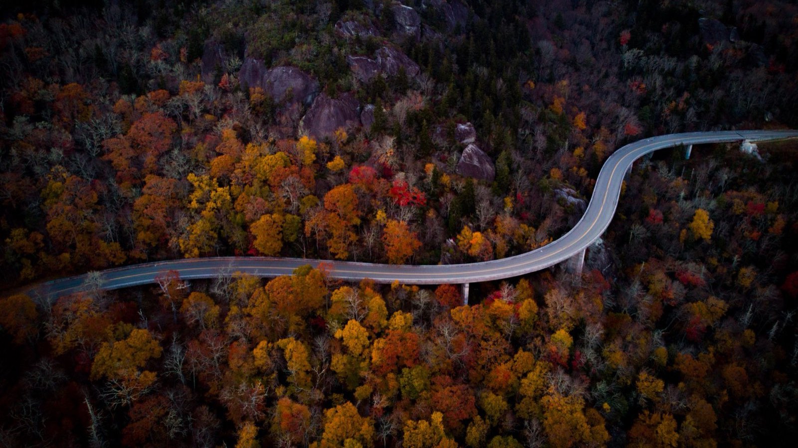
The Linn Cove Viaduct at milepost 304.4 is the photograph everyone wants: 1,243 feet of concrete curving around the shoulder of Grandfather, finished in 1983 for close to $10 million and named a National Civil Engineering Landmark. It sits inside the milepost 291.8 to 305.1 rehabilitation zone, and since July 13, 2026 the closed piece has been exactly the stretch from the Linn Cove parking area at milepost 304.4 down to the US 221 ramp at milepost 305.1. So you come at it from the north, not up from Linville, and follow the signed detour. The Linn Cove Visitor Center is closed. You drive across the viaduct, you cannot stop on it or walk it, so the photograph comes from the overlooks and from the Tanawha Trail. Check the closure map the morning you go, because the closed section moves as the work advances.
Timing your week
The useful rule comes from the biologists at Appalachian State, Howard Neufeld and Michael Denslow, who mapped it: for every 1,000 feet you gain in elevation, peak color arrives roughly a week earlier. Their map puts the high points of this itinerary, Mount Mitchell and Grandfather Mountain, in the earliest band of all, September 29 to October 9. The middle elevations run October 13 to 20, and Asheville itself does not turn until the last week of the month.
The caveat matters more than the rule. The map carries the warning on its own face: very warm weather can delay the onset of peak color by up to two weeks. If you’re locking in nonrefundable lodging in August, the week of October 13 is the best single compromise: the summits will be just past their peak, the middle elevations at theirs. Check the forecasts in late September before you finalize anything you can still change, and check them in the right place. Howard Neufeld retired from Appalachian State on July 27, 2026, after about fifteen years of the weekly reports, and the university’s page no longer carries them. He now publishes at fallcolorguy.org and on his Fall Color Guy Facebook page.
Because you’re basing in Asheville rather than moving each night, a later-than-expected peak costs you nothing. You just drive higher or lower depending on where the color actually is. That flexibility is the strongest argument for the hub approach this particular year. If the closures push you to look further north instead, the White Mountains fall foliage loop runs on the same elevation logic and peaks a week or two ahead of North Carolina.
What the three days cost
- Blue Ridge Parkway access: no entrance fee
- Mount Mitchell State Park day use: no fee
- Grandfather Mountain, peak fall rate: $35 adult, $33 senior 60+, $13 child 3 to 12, before taxes and fees
- Fuel: roughly 300 miles of driving across the three days, close to half of it on the day 3 highway run to Grandfather Mountain and back, plus whatever you cover in town
Two adults can do all three days of sightseeing for about $70 in admissions, and every cent of that goes to Grandfather Mountain. The expensive part is the bed. Asheville lodging in mid-October books out months ahead and prices accordingly, which is the real reason to have this settled in August. If you are building the trip from scratch rather than slotting into this one, how to plan a road trip covers the order to do things in.
Four things to get right
- Fill the tank in town. There are no gas stations on the Parkway itself. You exit for fuel, and on the closed-off sections the nearest exit can be a long way back.
- Download offline maps. Cell coverage on the high sections is patchy to nonexistent, and navigation apps have been slow to reflect these closures. More than one driver has been routed onto a barricaded segment.
- Start early on weekends. Craggy Gardens and Graveyard Fields have small lots that fill by mid-morning in October.
- Don’t walk into closed sections. Between mileposts 317.5 and 355.3 the Park Service prohibits recreation of any kind, and from Little Switzerland to Victor Crossing it prohibits access of any kind, foot traffic included. These are active landslide zones, not scenic shortcuts.
The Parkway will be whole again. Not this October. What you get instead is more than 110 unbroken miles of genuinely excellent road with fewer cars on it than a normal fall, because plenty of people read that the Parkway is damaged and cancelled the trip. Their loss.