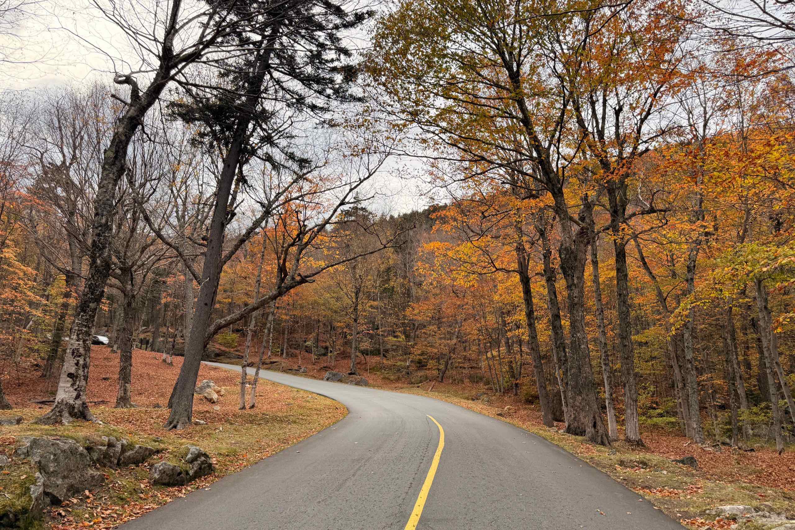
Most fall foliage guides to the White Mountains are wrong on two counts, and both cost you money. The Cannon Mountain aerial tramway, the ride every New Hampshire itinerary tells you to book, stopped running in October 2025 and will not be back for this season or the next two. And the Mount Washington Auto Road does not charge the flat car rate you keep seeing quoted. Here is a 3-day loop that works anyway, with what it actually costs in 2026.
The loop: Lincoln, Franconia Notch, Pinkham Notch, Kancamagus
Base your first night in Lincoln, at the western end of the Kancamagus Highway, and your second in North Conway at the eastern end. Day 1 covers Franconia Notch just north of Lincoln. Day 2 crosses to the Mount Washington Auto Road and drops south to North Conway. Day 3 runs the Kancamagus back west, which puts you at I-93 in Lincoln for the drive home.
Run it in that order for one reason: the Auto Road is the part of the trip weather can cancel outright. Putting it in the middle means you have a day on either side to swap it into if the summit is closed, which happens more often than the brochures let on. Reverse the loop if you are coming from the coast, but keep the Auto Road in the middle.
Day 1: Franconia Notch, and the tramway that is gone
I-93 runs straight through Franconia Notch and narrows to two lanes for part of it, which is unusual enough for an Interstate that the drive feels nothing like the highway that got you there. You can see the whole notch in a day without hurrying.
Flume Gorge is the one paid stop worth the money: a boardwalk up a granite gorge with the water running right beside you. Adult admission is $18 booked online and $21 if you turn up at the gate. Children aged 6 to 12 pay $16 online, $19 at the gate. Book online, both because it is cheaper and because the timed slots on foliage weekends go early. The season runs from early May to late October, and the closing date moves with the weather, so check before a late-October visit rather than assuming.
The part older guides get wrong: the Cannon Mountain aerial tramway is no longer running. Its last ride was October 26, 2025, after 45 years of service, and it will not carry passengers again in 2026. New Hampshire has appropriated $27.2 million toward a replacement, with total project estimates running from roughly $25 million to $33 million, and the current target is completion by December 1, 2028. Plan on a 2028 or 2029 reopening, not a 2026 one. If a site tells you to ride the tram for the foliage view, that site has not been updated in a year.
The view the tram sold you is still up there. You just have to walk for it. Park at the Echo Lake lot at the north end of the notch and take the trailhead across the road: roughly half a mile up to the ledges at Artist’s Bluff, or a 1.5-mile loop if you take in Bald Mountain on the way round. The ledges sit directly above Echo Lake and look south back into the notch, which is the photograph most people think they need a tram ticket for. Everything else here, the Basin, Echo Lake itself, the paved bike path down the notch, never depended on the tram at all.
Day 2: the Mount Washington Auto Road, and what it really costs
Getting there is the longest driving of the three days, and the route matters more than the mileage. Lincoln to Gorham is about 48 miles and a little over an hour: I-93 north through the notch, then US-3, then cut east on NH-115 to pick up US-2. Follow “US-3 to US-2” literally without that NH-115 shortcut and you swing north through Lancaster for roughly 17 extra miles and half an hour of nothing. The Auto Road entrance sits on NH-16 in Pinkham Notch, 8 miles south of Gorham.
The road itself climbs 7.6 miles to the 6,288-foot summit of Mount Washington, gaining around 4,000 feet at an average grade of 12 percent, with a stretch of hard-packed gravel partway up. Budget more time than the distance suggests. The operator puts the ascent at about 30 minutes and the descent at 30 to 45, so with any time at all at the top you are looking at two to two and a half hours from gate to gate, not the hour people pencil in.
The pricing detail that matters: the Auto Road charges per person, not per car. Adults 13 and over pay $36, children aged 4 to 12 pay $15, and children under 4 go free. A couple pays $72. Two adults with two school-age kids pay $102. Aggregator sites and older blog posts still quote a flat rate somewhere around $45 for “car and driver,” and if you build your budget on that number you will be short by a wide margin at the gate.
Three practical things. The summit makes its own weather and the road closes for it, sometimes with clear skies at the bottom, so check the road’s status the morning you plan to go rather than the night before. The 2026 season runs weekends from April 25 through May 22, then daily until November 1, and the posted hours are the last time you can start up rather than the time the road shuts, with everyone off the summit within 45 minutes of that. And the descent is harder on a car than the climb: low gear, off the brakes, because riding them down 7.6 miles of 12 percent grade is how people arrive at the bottom with none left.
From the Auto Road it is about 28 miles south on NH-16 to North Conway, call it 45 minutes on an empty road. It will not be empty. NH-16 through North Conway is the known bottleneck in these mountains and October is its worst month, so give the evening slack instead of a schedule.
Day 3: the Kancamagus, and the number nobody agrees on
The Kancamagus Highway is NH Route 112 between Conway and Lincoln, and it is the reason people drive to New Hampshire in October. You will see its length given as anything from 26 to 35 miles, which is not sloppiness so much as three different measurements: the Forest Service calls it 34 miles, New Hampshire’s tourism office says 34.5, and the federally designated National Scenic Byway segment is 26.5 miles, a shorter stretch inside the same road. The Federal Highway Administration suggests allowing an hour. Allow three if the leaves are turning, because the pullouts are the point and everyone else stops at them too.
Kancamagus Pass sits at roughly 2,855 feet, which is what the roadside sign says. That number does not appear on any Forest Service or USGS page I could reach, so take it as approximate rather than official.
Fill your tank in Lincoln or Conway. There is no gas, no restaurant and no lodging along the National Forest stretch in between, which is around 32 miles of nothing commercial. What you do get is Forest Service infrastructure: campgrounds at Big Rock, Hancock, Passaconaway, Jigger Johnson, Blackberry Crossing and Covered Bridge, vault toilets, the Lincoln Woods Visitor Center, and the Russell-Colbath Historic Site with a seasonal interpreter on hand. Do not count on cell service either. Download the map before you turn onto 112.
The recreation pass: $5, and when you actually need it
A White Mountain National Forest recreation pass costs $5 per vehicle per day, or $30 for the year. The household annual pass, which covers two vehicles, is where the Forest Service contradicts itself: one of its own site pages lists $40 and another lists $50, both last updated in March 2026. The $40 figure has more support, including the agency’s own mail-order form, but both pages are official and neither has been corrected. Budget $50 and be pleased if it is $40.
The claim you will read everywhere, that you need a pass to park at any trailhead on the Kancamagus, is not true. The Forest Service position is the opposite: most of the forest is free, and only designated developed sites charge. On the Kancamagus the fee sites are Lincoln Woods, Champney Falls, Covered Bridge, Boulder Loop, Lower Falls, Rocky Gorge, Russell-Colbath and Sabbaday Falls. East Pond, Hancock Notch and Greeley Pond are free. Several of the fee sites also charge nothing in winter, once they stop being maintained.
If your trip includes the hike everyone does off the Kanc
A 1.4-mile section of the Lincoln Woods Trail, from the Kancamagus Highway to the junction with the Osseo Trail, is closed from June 15 through November 2026 for riverbank stabilization and trail reconstruction. Read that carefully, because it is being reported badly: the trail as a whole, roughly 2.9 miles, is not closed. Parking, restrooms and access to the East Side Trail stay open at the Lincoln Woods Trailhead.
It matters most if you had the Pemigewasset Loop in mind. The Appalachian Mountain Club puts that loop at about 31 miles and says every alternate route around the closure runs longer, in the range of 36 to 40 miles. The same closure affects the usual approaches to Owl’s Head, 13 Falls, the Bonds, Guyot and Camp 16. For a driving trip this is a footnote. For anyone planning to walk into the Pemigewasset Wilderness this autumn, it changes the whole plan.
What the fixed costs come to
- Flume Gorge, two adults booked online: $36
- Mount Washington Auto Road, two adults: $72
- WMNF recreation pass: $5 for the one day you are actually on the Kancamagus, or $30 for the year
- Total fixed admissions for a couple: $113 for the trip, or $138 if the annual pass makes sense for you
Lodging is the variable that will decide your budget, not admissions. Foliage weekends in Lincoln and North Conway are the most expensive nights of the year in those towns, and midweek is a different trip financially. If you can move the dates, move them.
The 3-day version, at a glance
- Day 1: Franconia Notch. Flume Gorge, the Basin, Echo Lake, Artist’s Bluff. Sleep in Lincoln
- Day 2: Lincoln to Gorham, about 48 miles via I-93, US-3, NH-115 and US-2. Up the Auto Road, then 28 miles south on NH-16. Sleep in North Conway
- Day 3: The Kancamagus Highway west to Lincoln, about 34 miles and as many hours as you want to give it
Three days is the honest minimum for this loop. Two turns the Kancamagus into a transit leg, which defeats the point of coming. If you have a fourth day, spend it in North Conway and take Route 302 through Crawford Notch, which is the quietest of the three notches and the one nobody puts on a list. And if the autumn you want is western rather than New England, Trail Ridge Road in October is planned around a closure date rather than a color peak, which is a different kind of bet entirely.
For the planning side of a trip like this, the day-by-day itinerary method is the same one used here, and the road trip budget guide covers the parts that are not admissions. If you are still choosing a route, the best road trips in the USA puts this one in context against the longer drives. And if you would rather go south for the color, the Blue Ridge Parkway in fall runs on the same elevation logic, with a closure map you have to read before you book.